Just published in « Urban Climate »: the article « Local climate zone approach on local and micro scales: Dividing the urban open space »
Actualité publiée le 5 avril 2019
Abstract
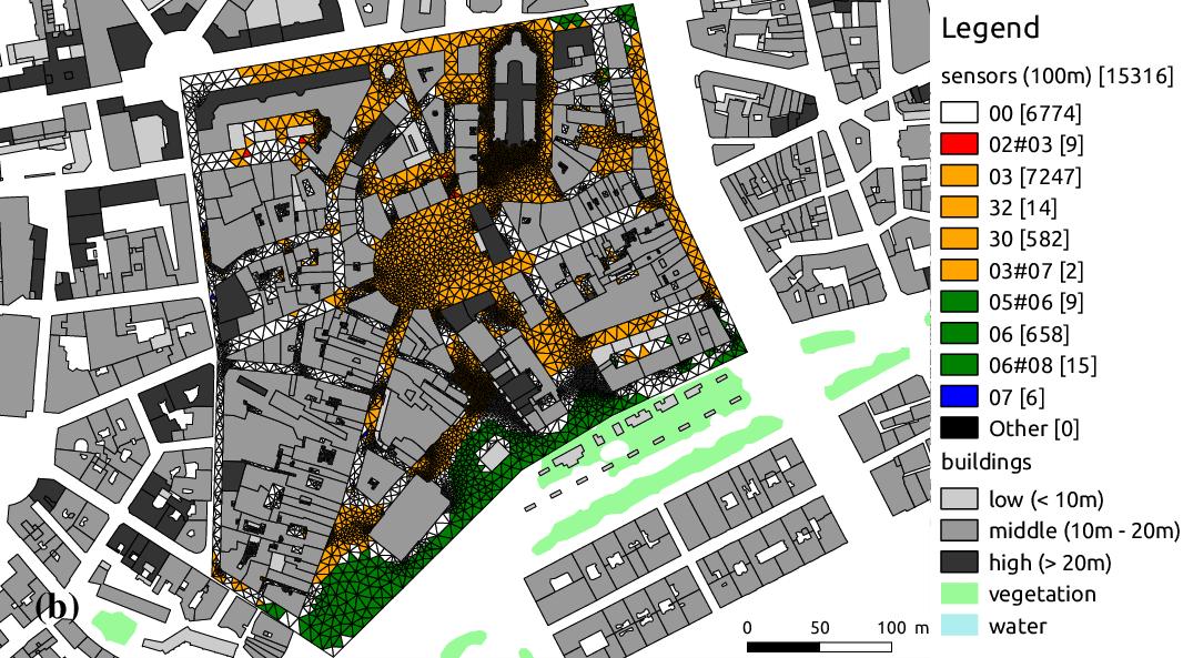
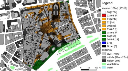
This article is a formalisation of the local climate zone (LCZ) classification on a local and micro scales. It is also an attempt to transpose this classification to a fine grained level of detail. The urban space is divided into virtual sensors for which five morphological indicators are calculated. Therefore, this work exposes a comparison of two methods dividing the urban space: the Delaunay triangulation versus a Skeletonization. These algorithms are based on a standard vector dataset and integrated in a free and open source Geographic Information System. These algorithms are applied to New York and districts of Nantes. The skeletonization presents the advantage of pulling down the calculation time without affecting the accuracy. Moreover, the methodology proposed is reproducible everywhere. In addition, the major LCZ obtained on the districts of Nantes are verified by comparison to previous measurements and classifications, which supports the results presented in this paper. Finally, the methodology and functionalities developed in this paper seem useful for the urban climate community and town planners, because LCZ can provide input data for numerical climate models that incorporate urban canopy parameters to forecast climate variables and forecast Urban heat island (UHI).
In Urban Climate Volume 28, June 2019, 100457

Catégorie : AAU, CRENAU
Tags : 2D GIS, Local climate zone, Standard data, Urban heat island, Urban morphological indicators, Urban skeleton